Coos Region...Adventure on Every Trail

South Slough Trails--Sunday, November 18, 2018
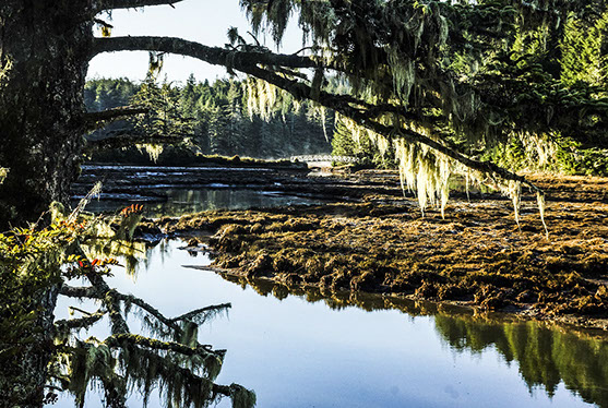
We will meet at the South Slough National Estuarine Reserve Interpretive Center parking lot at 10:00 AM. Then our hike leaders will take us on a series of trails through the reserve, including the Middle Creek trail, the Hidden Creek Trail, the Tunnel Trail, and the Sloughside trail. Short hikers can return to the Interpretive Center via the Railroad Trail and the Middle Creek Trail.
Those wanting a longer hike can take the North Creek Trail back to the Interpretive Center. Please note that there are no dogs allowed on the North Creek Trail, so if you are bringing your pet, you will be limited to the short hike.
Hikers wanting to explore more may want to complete the day with some hikes on the South Reserve Trails.
You can find a brochure about the South Slough trails here.
Location and Time
Driving Directions: From the North--From Hwy 101 in downtown Coos Bay follow the signs about 9 miles t0 Charleston. Shortly after the Charleston drawbridge, take a left on Seven Devils Road. Follow Seven Devils for 4.1 miles to the Interpretive Center.
From Bandon (and South): Follow 101 North to West Beaver Hill Road (9 miles North of Bandon). Turn left on W. Beaver Hill, toward Charleston. Follow W. Beaver Hill for 6.1 miles until it becomes Seven Devils Road. Follow Seven Devils for 2.2 miles to the Interpretive Center.
From Coquille: Drive to Coos Bay and follow the instructions from there.
Suggested Carpool sites and departure times:
- Coos Bay Visitor Center 9:15,
- Rays in Bandon— 9:00,
- Coquille Visitor Center—9:00,
- Dune Information Center in Reedsport— 8:40.