Coos Region...Adventure on Every Trail

Hiking for Health with the South Coast Striders
The South Coast Striders is a hiking group which plans and delivers free hikes in cooperation with the Bay Area Hospital, and the Coos County Women's Health Coalition. We are just a bunch of hikers who hike regularly and welcome others to come along.
If you are new to hiking with us (or just want to refresh yourself), check out the New Participants' Guide and "Things you should consider before you begin hiking."
For additional information or to receive notification of upcoming hikes - send email to southcoaststriders@gmail.com.
Southcoast Striders Upcoming Hikes
(Click on hike for description)
Scheduling for Remaining 2019 hikes is underway.
Send suggestions for hikes for 2019 to South Coast Striders
January 26, 2019 (Saturday)--Walkable North Bend--9:30--Complete
Learn about North Bend's fascinating history as you walk along the streets, sidewalks, and trails of the city. See the full description.

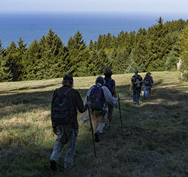
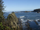
January 19, 2019 (Saturday)--Sunset Bay to Cape Arago--9:00--Complete
We'll hike from Sunset Bay, through Shore Acres, to Cape Arago, and Back. See the full details here
February 10, 2019 (Sunday)--Hall Lake/Dellenback Dunes--Winter Yardanging--9:30
We just did this hike recently, but the storms had flattened some of the Yardangs. We'll try it again in February. See the full description here.

February 23, 2019 (Saturday)--Siltcoos Lake--10:00
Details coming
March 9, 2019 (Saturday)--Heceta Head--(9:30)
The Hikes: 5-6 Mile Moderate hike including Beaches, the Heceta Head Lighthouse, and forested trails. We anticipate hiking the Lighthouse trail, the Hobbit Beach trail, and part of the China Creek Trail.
There will be an option to shorten the hike by eliminating any portion of the hike.
March 24, 2019 (Sunday) Bandon Dunes Trails (10:00)
Bandon Dunes is more than just a world class golf resort. There are more than six miles of trails on the resort grounds. We will explore those trails.
Long Hike: 6 mile scenic loop trail with woodlands, dunes, wetlands, a labyrinth (pictured below) and possibly a side trip to the beach at Bandon Dunes Resort. Rated moderate.
Short Hike: There are several opportunities to shorten the walk and return to the starting point.
You can end the trip at the Trails End Grill where you can eat your sack lunch or order from the menu.
April 6, 2019 (Saturday) Sweet Creek Falls Hikes (9:00)
The Hikes: The Sweet Creek/Beaver Creek area offers hikers a smorgasbord mountain stream and waterfalls experience. There will be 4 different hikes all of which are out and back on the same trail and rated moderate.
The first will be a 1/2 mile trip to view Beaver Creek Falls.
The second will be a 1.2 mile hike to a different viewpoint of Beaver Creek Falls.
The third hike will be 1.6 miles to Sweet Creek Falls.
The final and best hike of the day will be a 1.6 mile hike along Sweet Creek on a trail that meanders along the water and actually travels right over the creek on a railed catwalks that is bolted to the side of the canyon.
Altogether, you will hike 4.9 miles for the day.
If you want to take it a little easier you can cut out the third hike and take a break while the rest of the group goes on this section. Since the hikes are all “out and back” you can cut any of the hikes short and return to the parking area if you are getting tired. Plan on 4 hours for all the hikes—starting for home around 2pm.
Bring lunch and water and rain gear, dress in layers, and wear sturdy waterproof boots.
April 20, 2019 (Saturday) Cape Arago Trails (9:00)
Hike Description: Take a 2.5 mile one way trip from Cape Arago Point on the Arago Pack Trail toward Simpson Reef ( we will stop there briefly to check out the local wildlife) then along the Oregon Coast Trail to a point .25 miles S of Shore Acres Botanical Garden.
*Those wishing to end their hike here need to arrive a little early (8:30am) to set a vehicle beside the road .25 miles S of Shore Acres.
For those wanting a longer hike we will cross the highway and take the Arago Pack Trail back to Arago Point for a total of 6 miles of hiking. The Short hike is rated moderate and the long hike is rated moderate to difficult.
Plan on 2 hours for the short hike and 3 hours for the long hike. Restrooms are at beginning and end of the long hike and a short drive from end of short hike. Pack a lunch to enjoy along the way, or at the end.
May 11, 2019 (Saturday) Coos Bay History Walk (10:00)
May 19, 2019 (Sunday) Rocky Peak (9:30)
Hike Description: The harder hike: Reg Pullen will lead us on an exploration of this little known area of high rocky ridgeline habitat with views that reach from the Pacific Ocean to the Kalmiopsis Wilderness. This 2.3 mile section of the old Asa Carey trail (circa.1870) climbs 1300 feet to a rocky outcropping at 3029 feet. 4.6 mile round trip.
The full hike up to Rocky Peak has some very steep grades and is rated most difficult, but there are some changes that make this a kinder/gentler hike.
The Less Difficult Hike: You will have the option to cover the first moderate to difficult portion of the Rocky Peak trail for some nice views and some interesting flora.
We will stop at an overlook for lunch. You can rest or do a little exploring in some of the nearby meadows and wooded areas and then we follow our new and "Kinder" path that the local deer were taking back up to the road before returning to the trailhead for a total of 3 miles.
June 8, 2019 (Saturday) Eel Lake (10:00)
Join us for one of our favorite hikes.
This experience can be appropriate for paddlers as well as hikers.
There will be a 4 mile hike out and back along the Eel Lake Trail. This is a beautiful and fairly level trail which runs around the south edge of the lake for 3 miles.
The longer hike (6 miles total ) will proceed at a brisker pace out to the end of the trail and back for those of you who want more of a workout. Hikers can explore the lakes many inlets and maybe catch a glimpse of osprey, eagle and deer as you walk through forests of spruce, cedar, fir, and alder.
Eel Lake is also a very nice flat water paddle & has a swimming area.
Pack a lunch to eat in the picnic area after the hike.
If you are a paddler, you might consider coming early (7:30am) to paddle on the lake before the wind picks up. If you time it right you could get in a nice paddle and then go on the hike at 10 am.
June 23, 2019 (Sunday) Hanging Rock (7:30)
Hanging Rock in the Wild Rogue River Wilderness is perched at 3500 ft overlooking the Rogue River canyon and the rapids below. David Gray and Don Luce will lead this hike.
The Panther Ridge trail winds along this high ridge under magnificent stands of old growth timber with rhododendron and scrub oak and nest of bear grass.
Hikers can either hike the easy to moderate 1.9 mile round trip to Hanging Rock and back or they can extend their hike along the Panther Ridge trail to Clay Hill for a 5.5 mile total hike - rated difficult. Shuttle set up required. Hikers can finish the day with optional trips to Coquille Falls (1 mile moderate) and Elk Creek Falls (.25 miles easy), which are both on our way back toward Powers.
Bring at least 1 liter of water if you are taking the short hike and at least 2 if you plan on taking the longer hike.
Boots and walking sticks are recommended.
July 7, 2019 (Sunday) Blacklock Point (10:00)
Join us for this rugged 8.5 mile journey from Floras Lake to Blacklock Point along beaches, densely wooded trails and exposed rocky points with beautiful ocean views.
A beautiful hike with plenty of history and local lore in the mix.
This hike is rated difficult to most difficult.
Dress in layers, windbreaker with a hood is highly recommended. Bring water and something to eat.
Meet at the Boice-Cope County Park’s parking lot next to Floras Lake
July 13, 2019 (Saturday) Kentucky Falls (7:30)
Our first hike is to Kentucky Falls and back. Kentucky Falls area offers views of 3 waterfalls two of which drop over 100 feet. This hike is 2.2 miles down to falls then 2.2 miles back on switchback trail. It is rated moderate to difficult. Plan on 3.5 hours to complete the hike with plenty of time to relax, eat lunch, enjoy the falls and then walk back up the switch back trail at your leisure. (NOTE: After completing this hike, some hikers may want to drive to the N. Fork Smith River Trailhead and walk along the river.)
For those who want a more challenging hike join our long hike leaders as they continue another 6.5 miles down along the N. Fork Smith River trail. The trail winds back and forth over several rustic bridges through old growth forest of Douglas Fir, Hemlock, Western Red Cedar and Big Leaf Maples. We will make a side trip to the cable suspension bridge and eat lunch along the creek and soak our tired feet. Bring a towel.
The long hike is rated most difficult. Participants should plan on 6.5 hours for the total 9 miles of hiking.
The long hike may require a shuttle.
Long sleeve shirts, long pants, gloves, and some strap on sandals for wet crossings are required.
Bring lunch and water and raingear, dress in layers, and wear sturdy waterproof boots.
July 27, 2019 (Saturday) Cape Mountain (9:30)
The hike: Beautiful wooded trails and high meadows with views that go on for miles. We have put together a sampler of this wonderful 17 mile trail system that offers lots of options for hikers, mountain bikers and equestrians.
Our long hike will be 7 miles and will combine the Wapati Trail, Nelson Ridge Trail and Tasha trail.
We will lunch in the meadow at the site of an old lookout tower.
Hikers will have the option to shorten their hike to 3 miles by branching off on the Lookout Loop trail.
The short hike will be 3 miles and is rated moderate overall, but you still have to make the climb up to the lookout.
The longer hike is 7 miles and is rated difficult overall.
Dress for the weather and bring plenty of water and something to eat.
Hiking Sticks will make the climbing easier.
August 11, 2019 (Sunday) Bandon Historical Hike (10:00)
Join archaeologist and historian, Reg Pullen for a 4 mile walking tour of Bandon. Reg will share all the local lore and colorful history of Bandon while touring various historical points of interest. Bandon Mayor Mary Schamehorn will join Reg for part of this hike.
The total hike is 4 miles, rated moderate, with some sand walking involved and should last 2.5 to 3 hours.
The first part of the walk will take place in “Old Town Bandon” and if you aren’t up for the longer beach walk you can end your walk there.
This year we will also offer a faster paced version of this hike that will take you out by the schools and the City Park before returning along the beach and Beach Loop Road. This will be led by Museum Board Vice-President, Jim Proehl. Jim's version will emphasize the walking, with talks along the way, while Reg and Mary will talk about the history and then walk through the areas of interest.
Dress appropriately for the weather. A windbreaker with a hood is recommended for the beach section. Walking sticks might be helpful for the beginning of the beach walk. Bring water. You might want to pack a lunch to eat on the Bandon Boardwalk, or you might want to plan to eat at one of Bandon's many fine lunch spots.
After the hike you may want to visit the Bandon Historical Society Museum. Because this is on a Sunday, admission will be FREE, thanks to the "Free Summer Sundays" program sponsored by First Interstate Bank and Best Western Inn at Face Rock. Note that the museum will open a little early on the day of the hike to provide access to the restrooms.
August 18 Summer Sampler (short hikes) (10:00)
We will do two short hikes. The first hike will be on the New River Trails, South of Bandon. There are about 2 1/2 miles of trails at this site, and a Nature Center.
We'll follow that up with a trip further south to Port Orford Heads, where we will be able to hike on another couple of miles of trails and visit the museum at the lifeboat station.
If that isn't enough, you can visit Battle Rock and walk the Port Orford Beaches.
Details Here
September 1, 2019 Cape Arago Trails (9:00)
Hike Description: Take a 2.5 mile one way trip from Cape Arago Point on the Arago Pack Trail toward Simpson Reef ( we will stop there briefly to check out the local wildlife) then along the Oregon Coast Trail to a point .25 miles S of Shore Acres Botanical Garden.
*Those wishing to end their hike here need to arrive a little early (8:30am) to set a vehicle beside the road .25 miles S of Shore Acres.
For those wanting a longer hike we will cross the highway and take the Arago Pack Trail back to Arago Point for a total of 6 miles of hiking. The Short hike is rated moderate and the long hike is rated moderate to difficult.
Plan on 2 hours for the short hike and 3 hours for the long hike. Restrooms are at beginning and end of the long hike and a short drive from end of short hike. Pack a lunch to enjoy along the way, or at the end.
September 22, 2019 Camp Myrtlewood Trails (10:00)
Camp Myrtlewood is an environmental stewardship and hospitality ministry of the Church of the Brethren. The camp that will be hosting us is made up of 158 acres of temperate rainforest, streams, meadows and rustic buildings located about 12 miles from Myrtle Point. Launched in 1936 with a land donation, Camp hosts over 2000 people per year. This is the third time the Striders have done this hike. The first time six hardy souls braved heavy rains, but enjoyed every minute. Last year this was one of our most popular hikes.
We will hike the camp's trails, and short and long versions of the hike will be offered.
Hiking Sticks will make the climbing easier.
October 5, 2019 Tahkenitch Dunes and Three Mile Lake Trail(9:00)
Experience the amazing diversity of the Oregon coast range on either of these two hikes.
You can travel out along the Tahkenitch Dunes Trail as it winds through the woods to where Tahkenitch Creek empties onto the beach and return along the same trail for a 3.5 mile trip out and back. Participants will return to the parking area on their own. This hike should last 2.5—3 hours.
or
Take a longer more vigorous hike--a 6 mile loop combining the Tahkenitch Dune trail and the Threemile Lake trail. We will all hike together on the Tahkenitch Dune Trail to the beach then hike north along the beach then back through the dunes past the beautiful and remote Threemile lake then through a mature and mossy Spruce forest then back to the parking lot.
The long hike is rated difficult and should last 4 hours.
Bring lunch, plenty of water and dress in layers for hot and sunny to cold, foggy and windy weather.
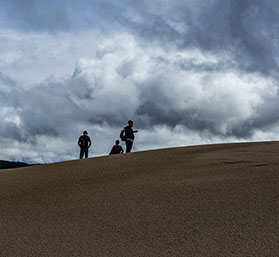
October 19, 2019 Dellenback Dunes (9:00)
There will be a couple of options for this hike. The first is a shorter hike of about 5 miles, across the dunes, to the beach and back. This can be shortened even more by turning around before the beach.
The longer hike will be a 9 mile total hike to the beach on the John Dellenback Dune Trail then south along the beach and return across the dunes from near 10 mile creek. This is a spectacular but very difficult hike in loose sand if it doesn’t rain prior to the hike. Dress in layers, bring plenty of water and lunch and plan on 5 hours to complete the hike.
The difficulty of both of these hikes comes from walking in loose sand...and the occasional steeper climbs up some dunes.
November 2, 2019 Golden and Silver Falls (10:00)
Hike Description: Here is a chance to view two beautiful nearby falls.
Short Option: We will make a 2.8 mile round trip hike that climbs a switchback trail through old growth forest of Douglas Fir, Big Leaf Maple and Oregon Myrtle trees up past two beautiful waterfalls both of which are over 100 ft. Those who wish to extend the short option may want to follow two short trails for additional views of the falls.
Long Option: For those wanting a longer hike we will be continuing another 1.7 miles beyond the falls for a 6.3 mile total trip. We will visit an old homestead site. Pack a lunch and plan to sit back above the falls and drink it all in.
Bring lunch and water and rain gear, dress in layers, and wear sturdy waterproof boots. Note that the crossing of Frog Creek CAN be very wet.
November 17, 2019 Humbug Mountain (10:00)
Description coming soon.
November 29, 2019 Black Friday Opt Outside Hike--Bastendorff Bog Plus (9:30)
Opt Outside on Black Friday 2019, and join us for a hike (good for working off the Thanksgiving feast).
Bastendorff Bog trail hike out and back, with some additional hiking in the area.
The hike will start in the Sunset Bay Day Use area. We'll hike from there, cross Cape Arago Hwy, go through the campground, and follow the bog trail out to Yoakam Point, which will provide an excellent view of Cape Arago Lighthouse (above), and a mystery feature pictured below. We will all then return to the starting point, and those wanting a longer hike will continue hiking along the coast to Shore Acres and back. You'll see some great ocean views and very interesting trees along the way.
Be prepared for any weather conditions with foul weather gear, food and water. Moderate, ~ 4-5 mostly flat miles.
December 14, 2019 Blossom Gulch and Beyond (9:30)
The long hike will take us along Blossom Gulch Trail up to the radio towers, then to Libby Rd and back to Blossom Gulch. The long hike will be approximately 10 miles, and is rated difficult. Dress in layers, bring rain gear, plenty of water and lunch, and plan on three to four hours to complete the hike.
For a short option, hikers can cut the trip short and return from the radio towers. Hikers taking this option will hike 4 miles.
Both the long and short hikes begin with a steep uphill climb.